Mountain Bike Safari-Stage 09: Tulfes – Mayrhofen
Important Infomation
🔖
Route Length
56.4 km
🜏
Elevation Gain
1949 hm
🞽
Difficulty
Hard
Elevation Profile
Description
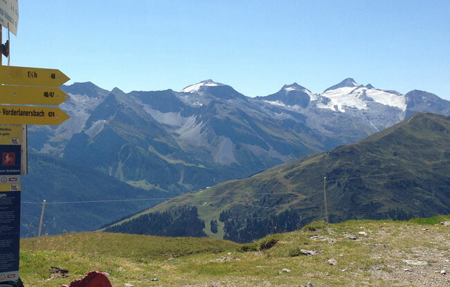
Trail description: Leave Tulfes eastward on lightly trafficked back roads and ride down into Inntal Valley to Volders, where you follow the Inn Cycle Path. Having crossed the village of Kolsass, turn right towards Weerberg in Weer. The trailhead for the climb atop Geiseljoch Col welcomes you to the ascent with a nearly immediate upward jolt at the outset. From Mitterweerberg, the route continues on pavement with a more moderate grade, taking you to Gasthof Innerst at an elevation of 1,300 meters. After a short distance along a hiking path, the route follows a forest road and continues upward past Weidener Hut (Nafing Hut), which is situated at 1,800 meters. The hut provides the perfect rest stop for bikers. Once replete and replenished, your vertical adventure continues on gravel. Between breaths, take in newly emerging views of the picturesque lake down on the valley bottom. The final push to the saddle top is nearly vertical; a thigh burner going up and one that calls for a 100-meter hike-a-bike section. From Geiseljoch Col, follow the hiking path that soon merges onto a gravel road to Hobalm. A last short climb and then you can careen down on pavement to Vorderlanersbach in Tuxertal Valley, which is a truly rewarding non-technical ride. The journey continues downhill on a paved road that leads to Finkenberg. Taking in scenic Zemmtal Valley along the way, you will finally reach the village of Mayrhofen.
Back