Eagle Walk Stage 02: Gaudeamushütte - Hintersteinersee
Important Infomation
🔖
Route Length
14.5 km
🜏
Elevation Gain
800 hm
🞍
Highest Point
1630 hm
🔲
Elevation Loss
1130 hm
🏀
Route Time Total
06:00 h
🞽
Difficulty
Medium
Starting Point: Gaudeamushütte
End Point: Hintersteiner See
Elevation Profile

Description
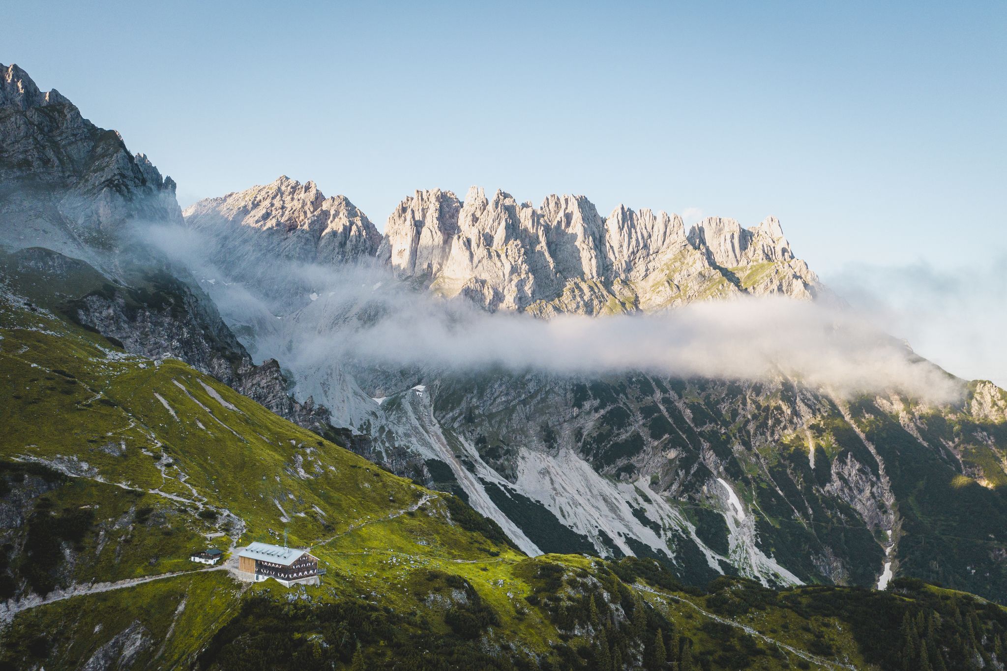
trail description: From Gaudeamus Hut, a steep path winds through fascinating Klamml Gorge, gaining 400 metres of elevation and bringing you to the highest-lying mountain lodge of Wilder Kaiser Mountain Range, Grutten Hut at an elevation of 1,620 metres. Head towards Ellmauer Tor first and turn onto Trail #824, 813 that winds westward through scree and talus slopes and dwarf pine fields. Cross a dry creek bed until a signed (“Gruttenhütte über Klamml”) track branches off; you must be sure footed and have a good head for heights to negotiate this section. The trail becomes increasingly rock-laden, slowing your pace as you clamber up and around large boulders, offering occasional views of Gaudeamus Hut below. You’ll make your way around and up the cliffs assisted by a fixed anchoring system of cables and a two-metre iron ladder. Follow the narrow, rocky trail bordered by towering rock faces to the right and a talus slope to the left. Traverse a debris-filled chute on your way to the entrance of Klamml Gorge. This is where your vertical adventure is just beginning. The via ferrata with bolted handholds and footholds heads off to the right from Gruttenkopf Peak—it's steep and requires use of hands in one short section going over a headwall. The trail is not dangerous, but hikers skittish on ledges may want to opt for another trail. Bear left at the end of the via ferrata, from where it’s only a short walk to Grutten Hut.
From Grutten Hut (1,620m), follow Gruttenweg Trail No. 14 and head southwest. At Krummbachegg, at an elevation of 1,400 metres, “Höhenweg” (literally, ‘high altitude trail’) No. 823 branches off from Gruttenweg Trail and runs westward (“Hintersteiner See”). Keep walking along the high altitude trail, which is as well called “Wilder-Kaiser-Path“, taking you through thin mixed woods and dwarf pines and cirques south of Treffauer Mountain and right around it. Continue hiking towards “Kaiser Hochalm”. From Kaiser Hochalm (1,417m), surrounded by wide open Alpine meadows, head downhill on the marked trail. Follow signage to “Steiner Hochalm” and hike down across mixed forest along Trail No. 823. At the end of the forest you'll reach a fork – bear right and follow the sign-posted trail that skirts the slope on the left hand side and takes you up to Steiner Hochalm. This quaint Alpine Pasture Hut is a great place to gather new strength over hearty culinary delicacies and quite often the harp is played here to sing-along. Southeast of the Alpine Pasture Hut, take the dirt road that runs down to “Hintersteiner See”. You’ll soon get a glimpse of this scenic, spring-fed aquatic jewel. Continue walking along a forest road that descends quickly (keep walking downhill). The route merges with the road that leads to Hintersteinersee Lake at Bärnstatt Inn/Bärnstatt Chapel. Walking along this road you’ll pass flower-strewn meadows and homes on your right hand side before reaching the eastern shore of Hintersteinersee Lake. Apart from the first and last section of this walk (Gaudeamus Hut & Grutten Hut in the beginning; Bärnstatt Inn at the end), there are no trailside eateries so be sure to pack plenty of water and food
Back